Corscombe
including Benville and Toller Whelme

 |
Corscombeincluding Benville and Toller Whelme |
 |
|
|
Corscombe is a large parish situated in the west of Dorset straddling the Downs, 4 miles north east from Beaminster and 9 miles south west of Yeovil. It is split by the Crewkerne to Maiden Newton turnpike, along the ridge 830 feet above sea level, following the alignment of a Roman road. The village of Corscombe is located on the northern slope 400 feet below. Its Parish Church, originally dedicated to St Michael was built around 1675. Between 1842 and 1865 the church was dedicated to St Mary and in 1876 restored and rebuilt to reflect a Tudor style with a Gothic tower containing six bells. The registers date from the year 1595. The village also maintained a day school and held two fairs, 18 June and 7 September on the Fair Field at Toller Down alongside the road to Beaminster. A telegraph station was located opposite. This was one of the series of stations that would pass messages from the Admiralty in London to the naval station at Plymouth. The area is 4918 acres and is principally used for dairy farming. |
|
Toller Whelme is an ecclesiastical parish
formed in 1871 from Corscombe. The church of St John was erected in
1870. Corscombe had a Post Office and a National School that was opened
in 1872. The population of the combined parishes in 1861 was 753 and in
1891 was 623 persons. Benville is 1½ miles south east and Pinnys or
Toller Whelme 2½ miles south. Note: In 1865 Toller Whelme was referred
to as Penny Toller. |
|
|
The Online Parish Clerk (OPC) for Corscombe is
John Childs |
|
| Census |
1841 Census 1851 Census 1861 Census 1871 Census 1881 Census 1891 Census 1901 Census |
| Parish Registers | The Parish Registers date from 1595 Baptisms 1595-1812 [Kim Parker], 1813-1847 [Pam Sharkey] Marriages 1595-1812 [Kim Parker], 1595-1837 [Phillimore & Nevill] Burials 1595-1812, 1813-1878 [Kim Parker], 1731-1879 [BT] [Terry Pine] |
| Other Records |
Corscombe Roll of Honour
[Paul Hawkins] Corscombe Roll of Honour [External, Bryan M Harvey] |
| Postal Directories | Extracts from postal & trade directories for 1851, 1855, 1859, 1865, 1875, 1915 |
| Maps | |
 |
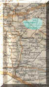
Click on the thumbnail opposite for a larger version gives a better idea of the parish boundary
|
|
View Larger Map |
|
| Records held at the Dorset History Centre [Ref PE-COR] |
Registers Christenings 1595-1636, 1653-1847. Marriages 1595-1602, 1610-1642, 1662-1837. Burials 1595-1604, 1609-1633, 1653-1655, 1660-1878 |
| Registration District
(for the purpose of civil registration births, marriages & deaths) |
1 Jul 1837-31 Mar 1937: Beaminster 1 Apr 1937-31 Mar 1997: Bridport 1 Apr 1997-30 Sep 2001: West Dorset 1 Oct 2001-17 Oct 2005: South & West Dorset |
|
|
|
|
|
|
Visitors to Dorset OPC
Copyright (c) 2025 Dorset OPC Project